Practise ILS approaches at any airport
Fly ILS approaches anywhere. This app uses the GPS location and an extensive databases of airport runways to simulate an ILS on any runway. The app allows you to create your own ILS anywhere. Choose a convenient ground feature in Google Maps, enter the co-ordinates and the 'runway' heading and threshold elevation for this feature then practice your ILS skills. Perfect for keeping your skills up-to-date without annoying your local airfield neighbours and without paying any navigation fees.
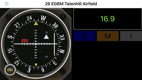
The display shows an OBS, with localiser, glideslope, to/from flags and GS and LOC flags. It also displays the slant angle DME and Outer, Middle and Inner markers.
PLEASE NOTE:
This software is for VFR training purposes only and should not be used in circumstances that may result in injury or death. It is not intended to replace a certified navigation device. We do not guarantee the accuracy and comprehensiveness of the information provided.
The downloaded approach database is provided for informational purpose only. It is not complete and may contain erroneous data.
You should always use official aeronautical documentation (AIP) when preparing and performing a flight. You should always use certified navigation devices when performing a flight. This software is provided ‘as-is’, without any express or implied warranty. In no event will the authors or third party data providers be held liable for any damages arising from the use of this software
YOUR USE OF THIS APPLICATION IS AT YOUR SOLE RISK
ILS approaches
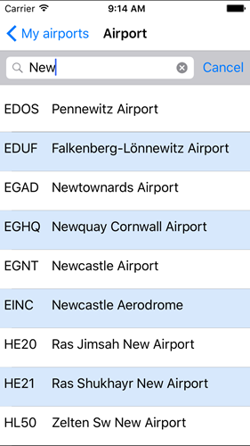
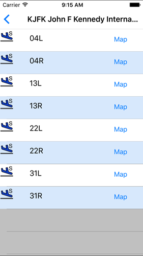
Select one of 30,000 approaches at tens of thousands of airports and practise flying them.
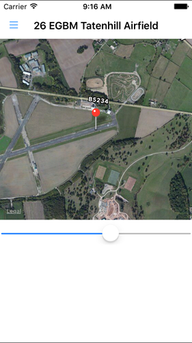
Check the touchdown location
View a map of the approach to make sure the approach location is correct